Site Information
There are two types of sites being studies in this project, which we’re calling high and low priority sites. High priority sites are specific fluddles where we plan to collect information about the physical and biological characteristics about the site. All of the high priority sites are on land where we have the explicit permission of the landowner to work and where we have explicit permission to monitor. If you live or bird near one of our high-priority sites, we strongly encourage that you survey these sites, since your data will have the most impact.
Low priority sites are just any other fluddles that you decide to visit and use our protocol at. While we won’t be carefully tracking these sites throughout migration, data collected from these sites can be used to help us answer other questions.
Please exercise caution when surveying at these locations. Many of the sites are located near or on roads, which may be busy. If you feel unsafe at a location for any reason, please do not continue to survey. Your safety is more important than the data. Where possible, survey points were placed in locations with sufficient area to park a car safely off the road, though this may not be the case at all sites.
Additionally, please do not block farm access lanes or enter fields. Additionally, if farmers are applying pesticides, please avoid surveying the area for your own health.
For more information about the scientific goals of this project, please see the about page.
Site Map
The map below shows all of the fluddle sites that have been located as part of this project. Locations marked with a red star are high priority monitored sites where we are collaborating with the landowner to collect data. Each point marks the suggested location from which you should survey that fluddle and we provide a rough estimate of the flooding extent of each site. Sites marked with a blue dot represent all other fluddle sites that have been identified by volunteers.
High Priority Sites
There are currently 3 high priority sites that we will be monitoring during the 2026 spring season. Each site is described in detail below. We plan to add a few more sites, so check back regularly.
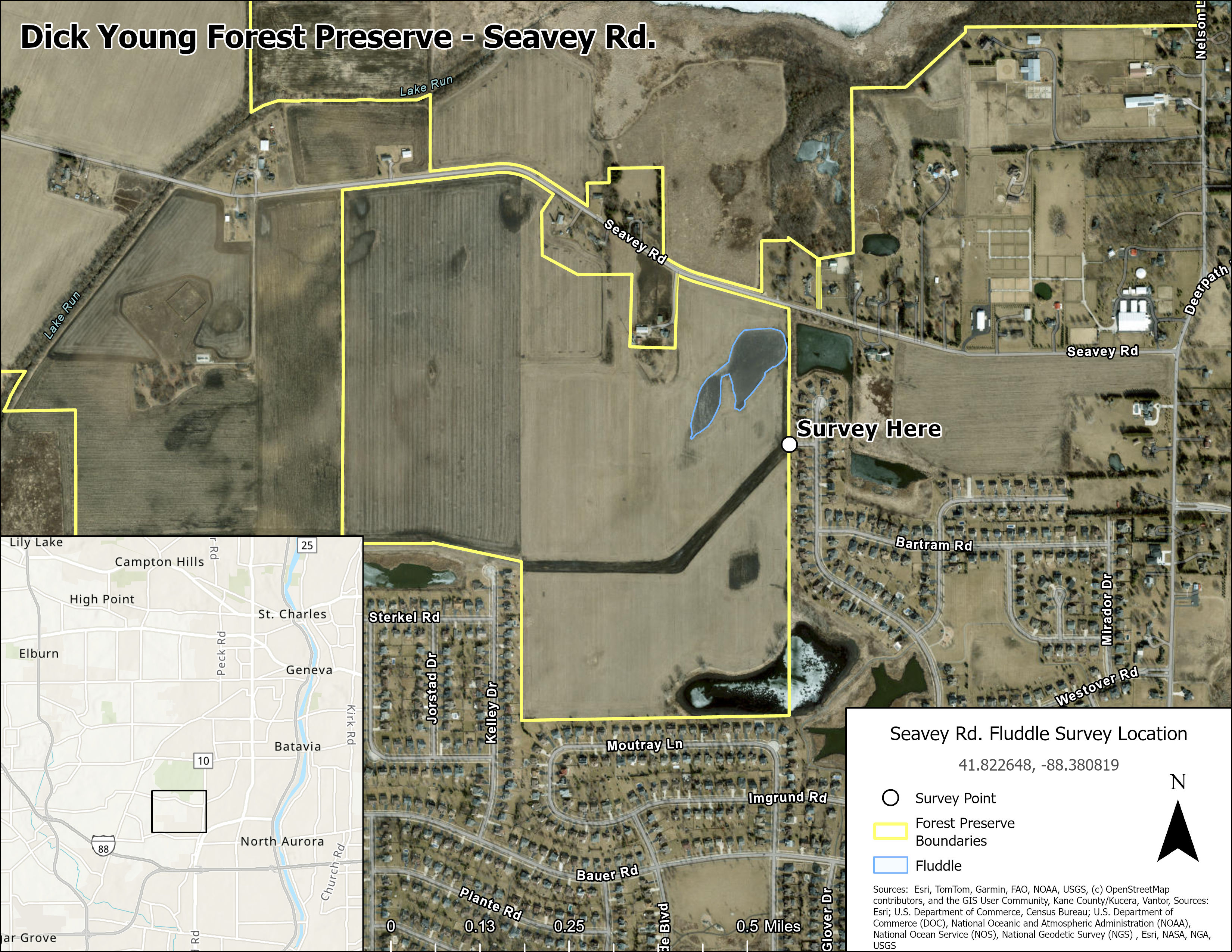
Seavey Rd. Fluddle
- Dick Young Forest Preserve, Kane County
- 41.822648, -88.380819
- Google Maps Pin: https://maps.app.goo.gl/4MWMXh9gofKDb8K4A
- eBird Hotspot: https://ebird.org/hotspot/L7929112
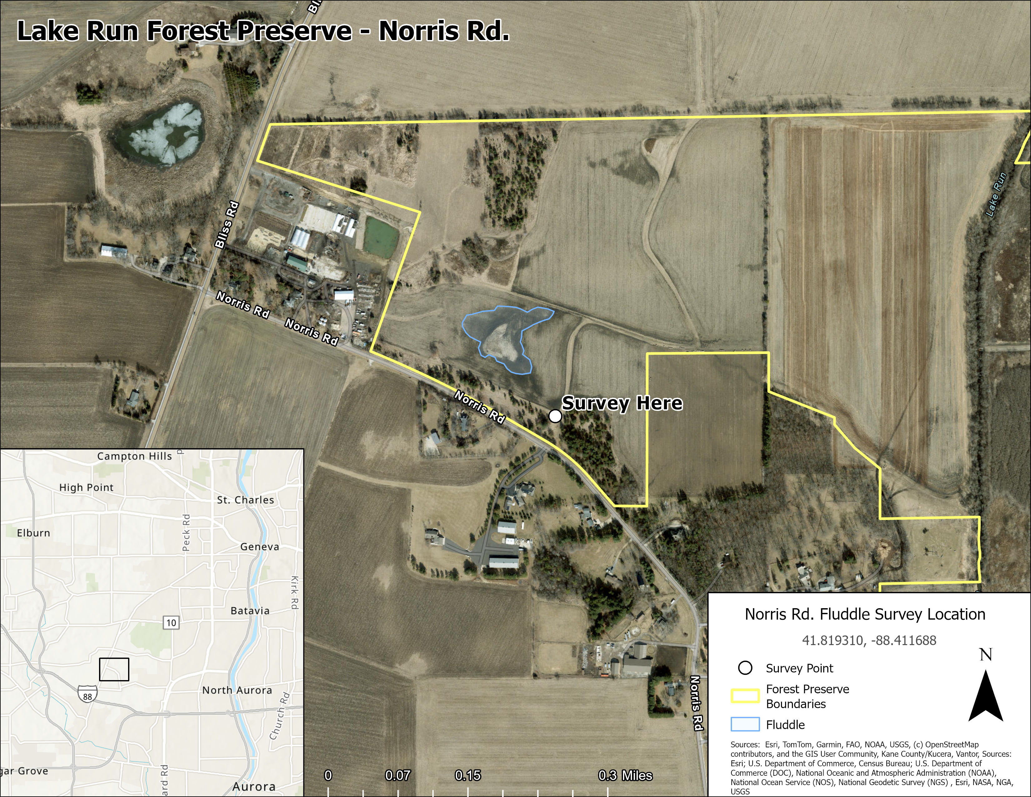
Norris Rd. Fluddle
- Lake Run Forest Preserve, Kane County
- 41.819310, -88.411688
- Google Maps Pin: https://maps.app.goo.gl/re9HuaDknAtDHVjz5
- eBird Hotspot: https://ebird.org/hotspot/L61395335
Please do not park in the access lane! We don’t want to obstruct the farmer’s access to the field. Please park either along the road or in the grassy area by the treeline to the east of the access lane.
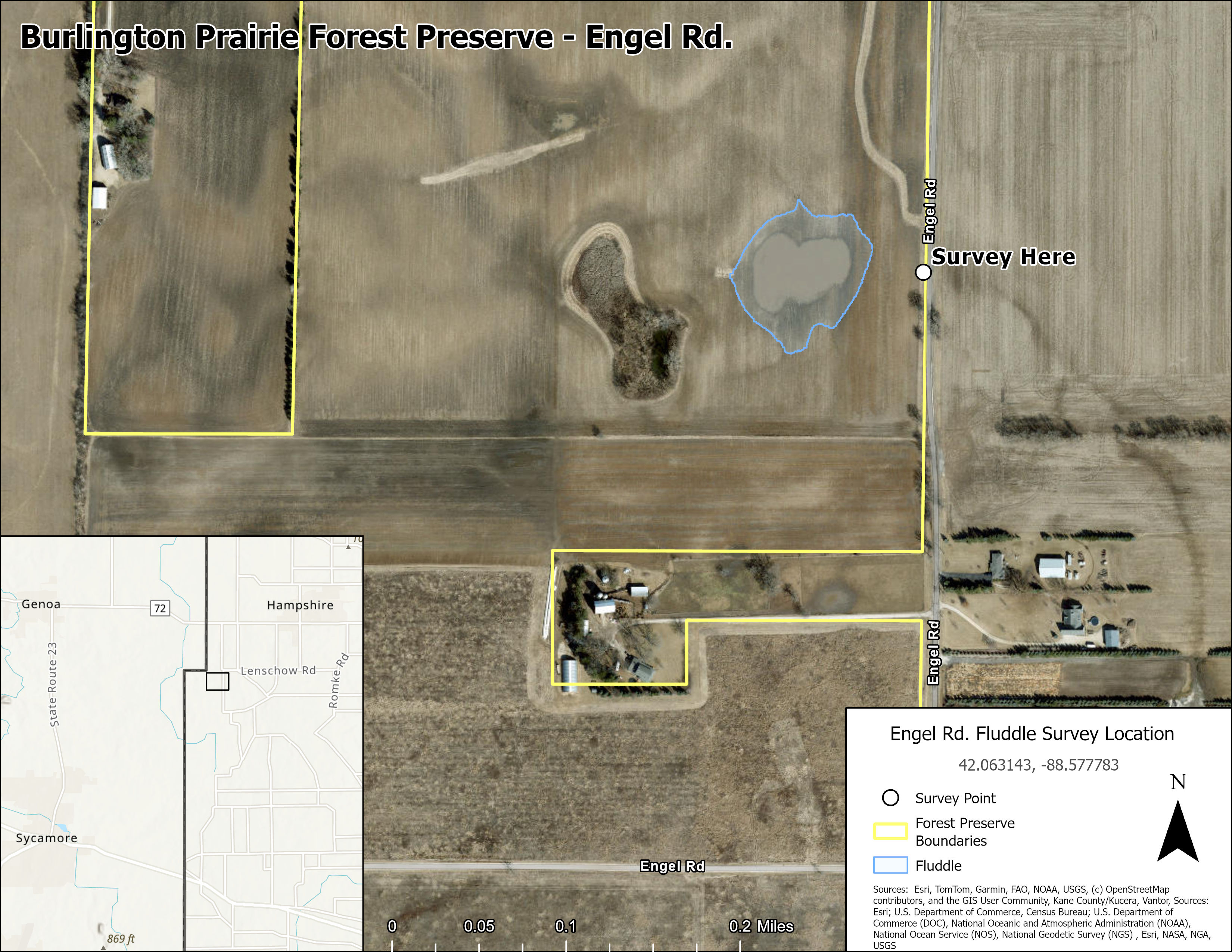
Engel Rd. Fluddle
- Burlington Prairie Forest Preserve, Kane County
- 42.063143, -88.577783
- Google Maps Pin: https://maps.app.goo.gl/MvbK2Br1ZMPD3fqNA
- eBird Hotspot: https://ebird.org/hotspot/L61395562
We plan to add more high-priority sites as the project continues, so check back here occasionally.